Reach: 7 (Southern Route)
Distance: 8 Miles from Netul Landing to Smith Point and back
Chart: NOAA 18521, Columbia River: Pacific Ocean to Harrington Point
Skill level: Beginner
We’re beginning at the end.
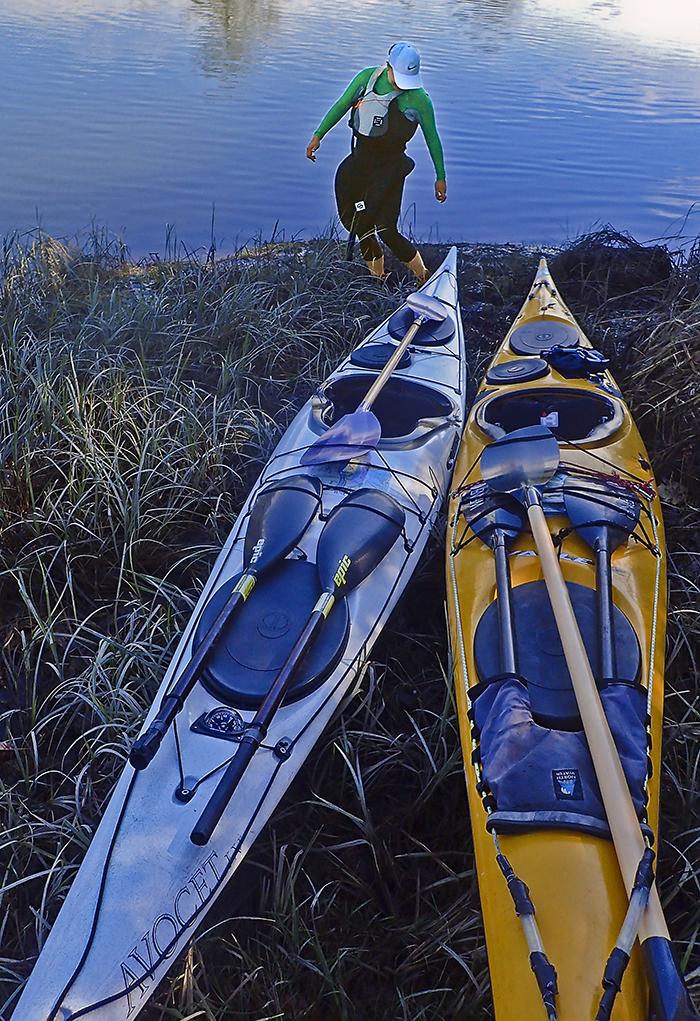
Our paddle starts from Netul Landing on the Lewis and Clark River, the endpoint of the Lower Columbia River Water Trail on the Oregon shore. A quarter mile away is Fort Clatsop, where the Meriwether Lewis, William Clark, and the Corps of Discovery spent the very wet winter of 1805-1806, eating near-spoiled elk meat and weathering 94 days of cold rain. Our experience is different: sunny, calm, and too warm for splash tops. We’ll ride the ebb current down the Lewis and Clark River to the open waters of Youngs Bay. Then we’ll choose our route around the Bay until the tide turns and pushes us back up the river.
The end of the Water Trail is muddy. As we descend Netul Landing’s ramp past the end of the concrete, we find ourselves stuck in low-tide river mud above our ankles. We try to wriggle our feet free without losing our shoes. We splash about clumsily, with strange sucking sounds interspersed with laughter. Then we’re afloat.
Like its compatriots just inside the Columbia mouth—the Youngs, Skipanon, Chinook, Deep and Grays—the Lewis and Clark River is a slow-moving tidal river that wanders through the low hills along the Columbia and a mix of rural residential and forest land. These rivers have seen a random assemblage of historical use—moorages, old docks, farms, tide gates, canneries, even fishing for salmon with horse-drawn nets. Derelict pilings provide us with a slalom course for our kayaks, minus the snow and gravity.
With lowlands and tidal changes, these coastal rivers also offer endless side channels to explore. We venture up a few of them, paddling under a new bridge that’s part of the Netul Trail from the landing to the Fort. A bunch of kids walk above us with clipboards, a sure sign of an educational field trip in progress. The channel keeps going, but discretion is the better part of valor, at least for now: the tide is dropping, and soon these channels will be dry. But the dropping tide does provide a feeding zone for wading birds probing the mud for invertebrates. We try to get close to lesser yellowlegs, herons, and killdeer, without much success.
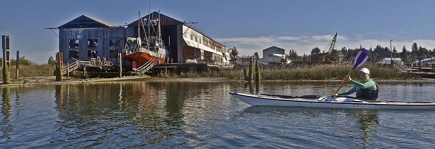
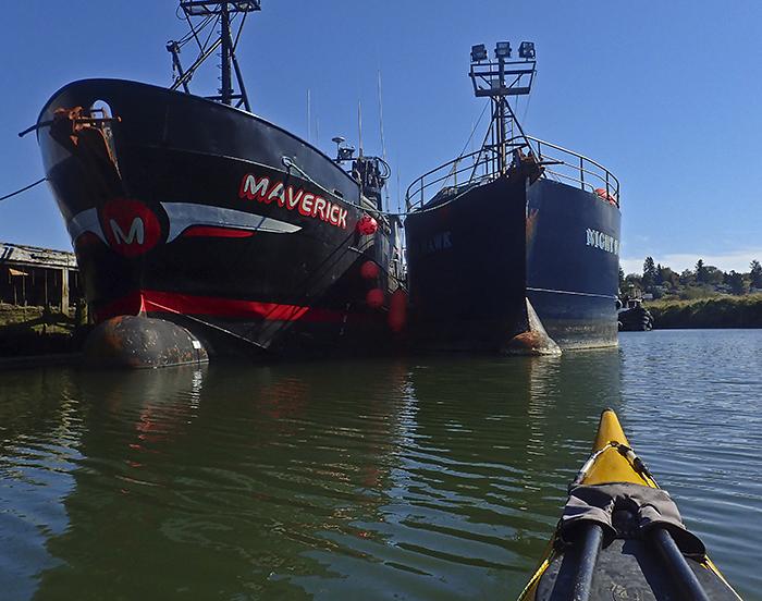
Soon the river widens as it approaches the entrance to Youngs Bay. Streamside forest gives way to marsh grasses. Amidst the grasses is an incongruity: a big rusting drydock, with a large fishing boat pulled out of the water. Next to the moorage is a series of old fishing boats in need of paint jobs and cleanings—and one that’s very new and spiffy-looking, the Maverick. Amy recognizes it as one of the crab boats from the Alaskan fishing reality TV show The Deadliest Catch.
Entering the open waters of Youngs Bay, we ponder our options. On windy days, the shallow waters of Youngs Bay can be choppy when a northwest wind stands up an outgoing tide. We could paddle up the Youngs River, along the Oregon shore toward Warrenton, or northeast to Youngs Bay Marine Park.
With the ultra-calm conditions, we opt for a fourth option: crossing the two-mile wide bay toward the south end of Astoria’s Coxcomb Hill. We pass several pilings covered with cormorants and the occasional eagle, trying to avoid spooking them off their perch. We find a beach and pull ashore. Lacking the elk meat that the Corps of Discovery ate for the season, we make do with turkey sandwiches on sourdough.
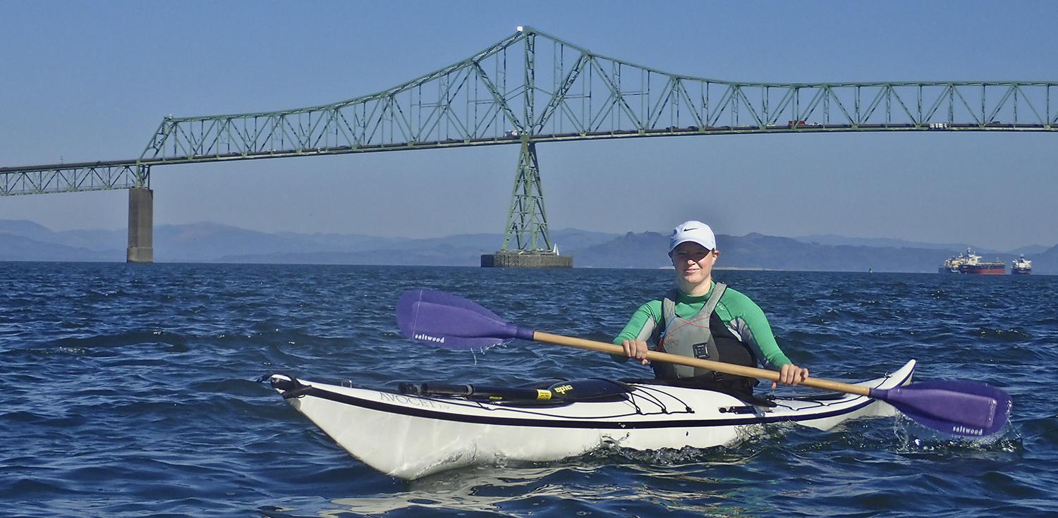
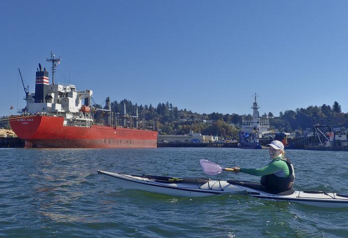
We ride the last of the ebb under the Youngs Bay Bridge connecting Astoria to Clatsop Spit and the Oregon coast. At Smith Point, we turn and enter the main Columbia River. It was originally named Point George by George Vancouver’s expedition in 1796. Lewis and Clark renamed the densely forested area Meriweather’s point, and noted “A Stiff breese from the S. W. which raised Considerable Swells.” Today there’s neither forest breeze nor swells, just us two kayakers and a family of cyclists. We round Smith Point and paddle along the Astoria Port and waterfront, where we’re waved at by a family standing along the dock and barked at by a few sea lions. We paddle about a quarter mile toward the Lewis & Clark bridge, and then turn around to ride the tide back the way we came, setting a diagonal course across Youngs Bay.

Before long, we’re back in the Lewis and Clark River, where the rising tide gives us more time to explore side channels. We soon realize that we can trace a route upriver through the now-interconnected sloughs that takes us nearly all the way back to Netul Landing. Mercifully, the boat ramp is far less muddy with the rising tide. We load our boats next to a couple loading their bikes after cycling the Fort to Sea Trail.
It’s hard to follow in the wakes of explorers like Vancouver and Lewis and Clark and not wonder what the area looked like two hundred years ago. The jetties have altered the complex hydrodynamics of the Columbia’s mouth, and houses and car dealerships are visible across Youngs Bay where they described dense forests. We’re a long way from hewing a fort out of the forest and hunting for elk meat. But the heritage of the past two centuries of river use is still in place.
Why you should go: A meandering exploration of a coastal river loaded with history, with options for paddling routes around Youngs Bay.
If you go: Watch the tides. Most trips are done with the tidal conveyer belt in both directions. On windy days, watch for wind-against-tide conditions that create chop in the shallow waters of Youngs Bay.
Distance: 2 miles to Youngs Bay from Netul Landing, another 2 to Smith Point.
Launch and Land: Netul Landing, ¼ mile south of Fort Clatsop. Other launch options are Youngs Bay Marine Park for exploring the Youngs River, the Warrenton Boat Ramp for access to the Skipanon, and the Hammond Boat Basin.
Worth Exploring: Fort Clatsop’s museum and replica fort is ¼ mile from the landing, connected by a trail. From Fort Clatsop you can also take the Fort to Sea Trail, a 2-mile trail that ends at the Pacific at Sunset Beach.