Reach: 2-3
Distance: 43 miles around the island, with shorter paddles easily available
Chart: NOAA Chart 18525, Columbia River, St Helens to Vancouver
Skill level: Beginner to intermediate, based on distance
On every long paddle, there’s a point where everything blurs. One bend in the river merges with the next, the mind wanders, and the rhythm of paddle strokes becomes all there is. It can be part reverie, part monotony, depending on how happy you are to have your mind float around, and how tired you are. On this day, I’m a bit tired.
The blurring came in Multnomah Channel somewhere between milepost 11 and 18, roughly mile 30 or so of a 43-mile weekend around Sauvie Island. I’d done the first 26 miles the day before. Those miles had gone smoothly, but there were a lot of them. With rows of trees on one side and agricultural dikes on the other, his stretch of Multnomah Channel was fairly uniform with no distinctive features like houseboats to check out. The sky was calm, breezeless, overcast. I was fighting mild ebb current. Staying in the eddies made it easier—but kept me in the less interesting diked side of the channel. And the steady energy burn of the last day and a half had me thinking about food. Wapato Greenway finally came into view for a much-needed snack stop.
I’d launched from Frenchman’s Bar in Vancouver the morning before for a solo paddle around Sauvie Island. Named Wapato island by Lewis and Clark, the massive island—one of the largest inland islands in the country—sits squarely atop the transition between worlds. Its southern end buts against the North Portland industrial zone. Its north end is firmly in the urban-rural interface; a mix of working farms, bucolic rural escapes for city dwellers, and the transition to bedroom communities for the Metro area. Bordered on one side by the wide open Columbia and the other by the protected, narrow Multnomah Channel branch of the Willamette River, I’d always wanted to paddle around the island in one fell swoop, knitting together day trips I’ve done dispersed over decades. This weekend I finally launched the circumnavigation as a solo paddle.
It became a solo paddle by accident. Plans A and B had fell victim to friends’ schedules and friends’ injured backs and wrists. Summer was turning to fall, and I was primed for what looked like possibly the last good weather camping weekend in a while. In past years I’d done a lot of solo kayak camping, but had fallen out of the habit. I also craved a workout, and the long mileage around the island made the efficiency of solo travel appealing. So did the chance to ruminate with my own thoughts a bit after two weeks packed with meetings and social gatherings. And the tides were right for a counterclockwise loop. So Saturday evening I threw my gear together, found a pet-sitter, and went.
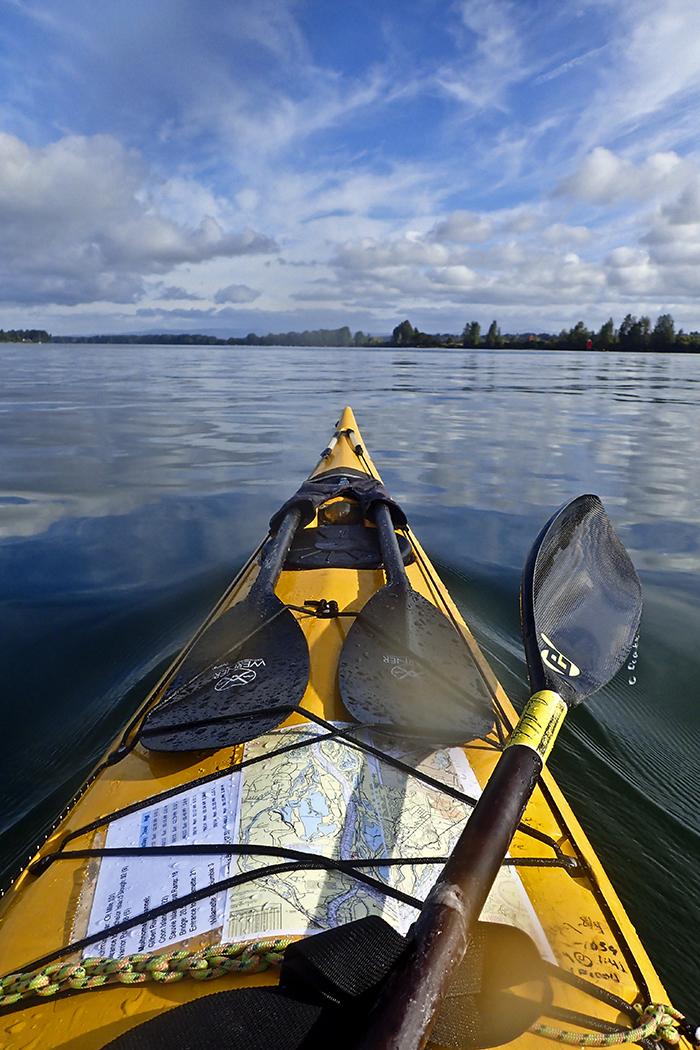
Frenchman’s Bar, a public park in Vancouver, greets the sea kayaker with a long carry to the water, but it’s the right launch for the tides this weekend. By 9 am, it’s already hot enough that kids are swimming as I pack my boat. From Frenchman’s Bar, it’s 14 miles to Warrior Rock at Sauvie’s downstream tip. There my route will hang a sharp left, heading upstream in Multnomah Channel. If I can get to Warrior Point and make that turn around 1 PM, the flood current will slow the flow so that making progress up Multnomah Channel isn’t a major fight, even if it doesn’t reverse it entirely. That means 14 miles in 4 hours: a pace of 3.5 mph, a bit faster than the average cruising pace, plus breaks. Then another 8 miles up Multnomah Channel to Coon Island, a public park with boat-in camping. A total of 22 miles, the last 8 the hardest. I head for the middle of the river to ride the downstream current.
Vs of honking geese fill the sky, reminding me that summer is turning to fall. Osprey nests sit empty, although the birds themselves haven’t flown south yet. A flock of western grebes bob along, probably en route from breeding areas in Eastern Oregon to wintering grounds on the coast.
I settle into a rhythm, setting a faster-than usual stroke rate. Paddle strokes blend and the lowland cottonwood and ash forests of Washington, Sauvie Island’s farmhouses, and various fishing boats slide by. Before I know it, I’m at Bachelor Point, part of Ridgefield National Wildlife Refuge, where the Bachelor Island Slough leads to the town of Ridgefield. I look at my watch. It’s before 11. I’ve covered 9 miles in under and hour and a half, a pace twice what I needed to make the turn by 1 pm. The river current must be stronger than I thought.
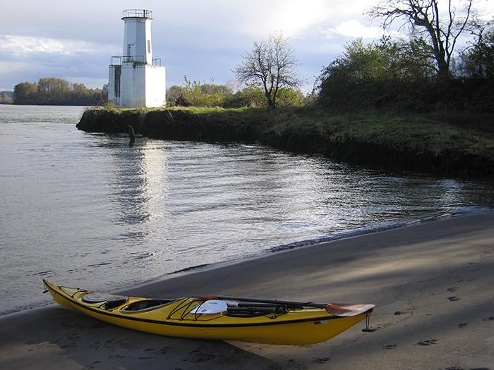
From the fishing boat on my right, a shout comes up. They’ve got a fish on, and I watch as they reel in what turns out to be an arm-length Chinook. Then I paddle into the main current, with a more relaxed pace. Five more miles of threading sailboats and fishing boats brings me to Warrior Rock lighthouse, where I bump into some former kayak students from a local club. After lunch and a lot of chatting, I round the point into Multnomah Channel. The current’s still flowing seaward, but it’s slower, and it’s easy to work the slow water on the inside of the bends. By 4 pm I’m paddling up to the dock at Coon Island, an island campground managed by Columbia County Parks.
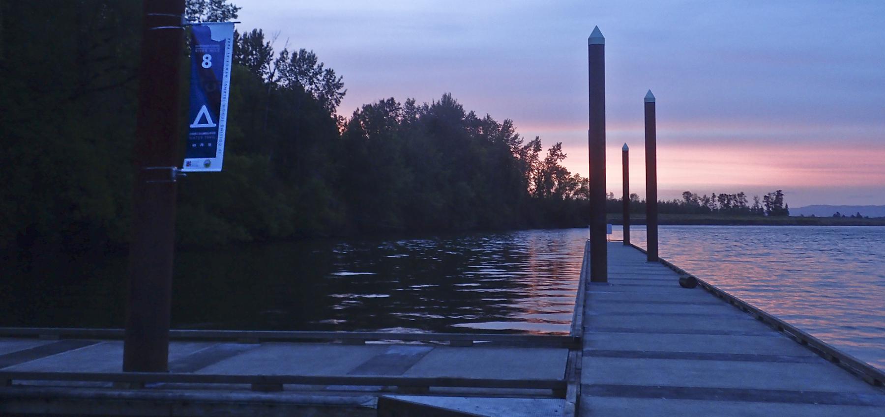
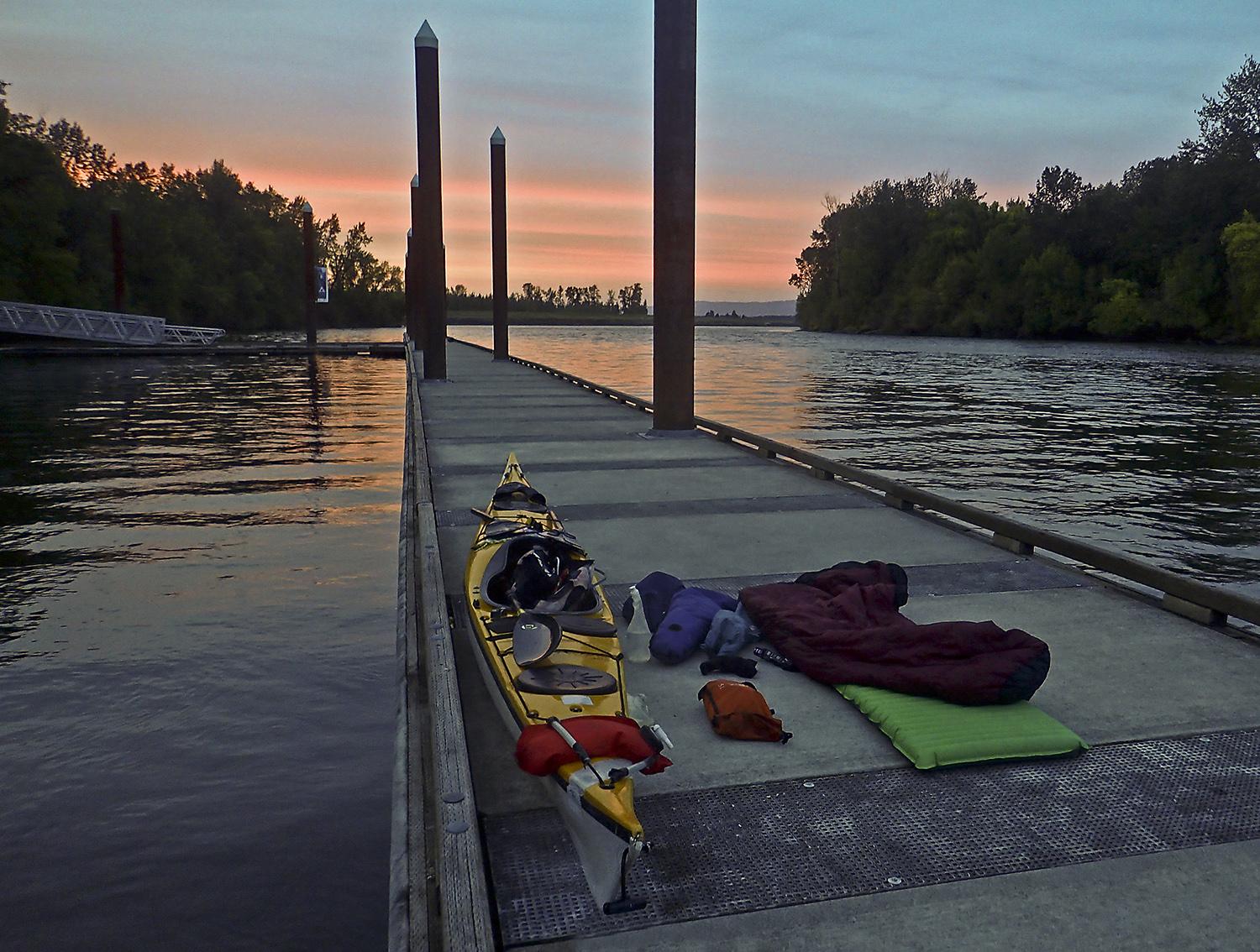
Coon Island is a small treed island with a grassy center and docks on both sides. The campsites are mostly geared for larger boats: there are two docks but no beach landing, and it’s a long way to carry gear up to the sites. It’s Sunday, so the powerboats are clearing out. I soon have the island to myself, so I decide to skip hauling gear and simply set up camp at the end of the dock—warm weather and clear skies make a tent unnecessary. Famished after the long paddle, I eat both that night’s dinner and the spare one I brought as a backup. I spend an hour reading my friend Donna Matrazzo’s book about conservation on Sauvie Island. There’s no better place to read it, and it brings me back to campaigns when I was cutting my teeth in conservation. I chuckle to read old stories about people I still work with today. Tomorrow I’ll paddle past Donna’s houseboat along Multnomah Channel. The sky and the river turn purple, and after I drift off I’m woken by both a nearby owl and the first sandhill cranes of the season.
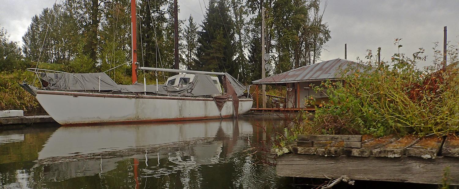
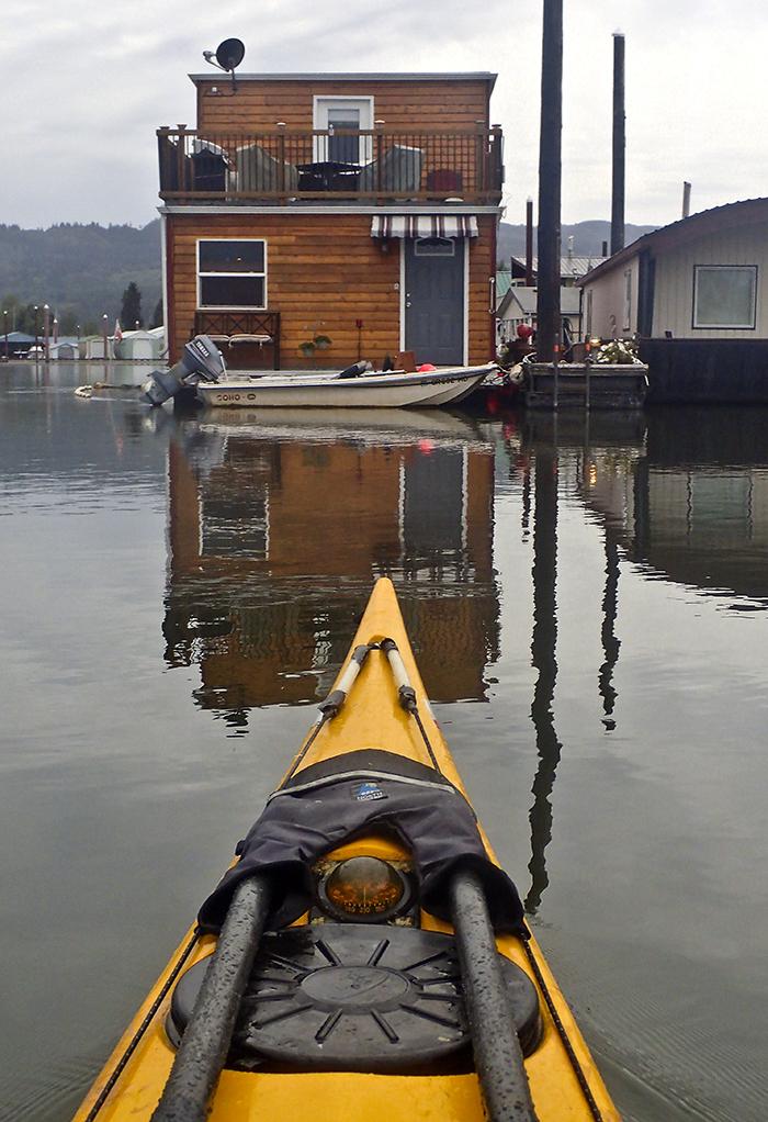
In the morning I shake off the morning dew and sleepiness, and hop back in my boat while the fog is still burning off. Multnomah Channel is a 21-mile twisting waterway that separates Sauvie Island from the Highway 30 corridor. The island’s transition from rural farmland to metropolitan backyard hasn’t been without struggles. Traffic can snarl on weekends for summer berry-picking and fall pumpkin patching and corn mazes. On this Monday morning, the only two vehicles are two gravel trucks and a school bus. This section of Multnomah Channel is also where the houseboats and moorages begin. They start out, as much real estate does, lowbrow at the northern end and more dense, manicured, and expensive-looking as we get closer to Portland. The first set is in a state of decay, with invasive reed canarygrass growing in an old sailboat that looked like it was worth a lot back in the day.
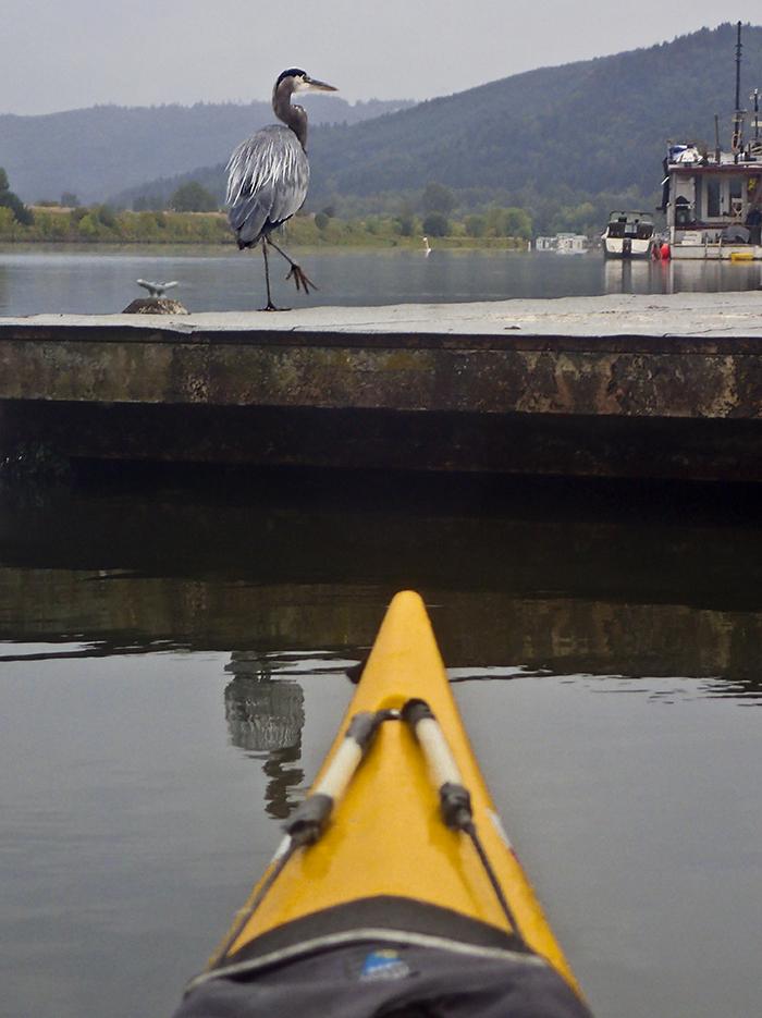
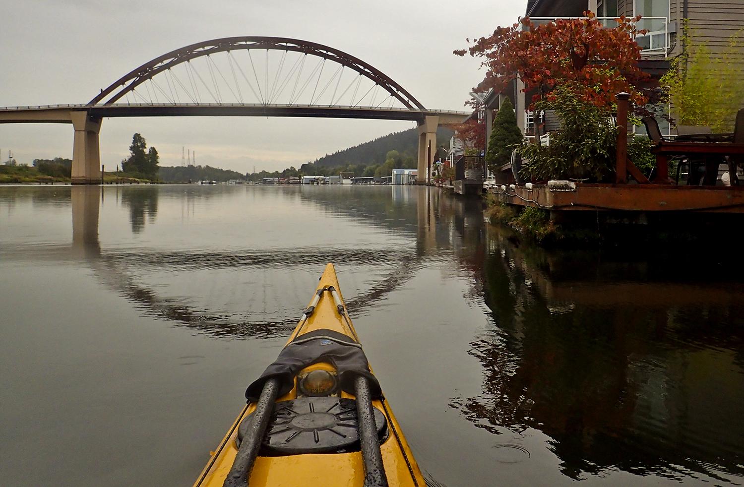
At milepost 11, I paddle by Mark’s on the Channel (RIP, Mark’s closed in 2020), a floating restaurant accessible from the river, sporting a Water Trail sign. Coffee and something more substantial than oatmeal sounds good, but Mark’s is closed on Mondays. Then another houseboat oddity: one has the word “Kafoury” in big letters, Portland’s most prominent political family. The name’s usually associated with fashionable inner Portland neighborhoods more than weathered houseboats. Fatigue sets in. I pass Burlington Bottoms, technically the “J.R. Palensky Wildlife Mitigation Area,” a 400-acre natural area on the mainland side of the river, and then a mass of houseboats and boat moorages. At long last, the arc of the Sauvie Island Bridge comes into view, and then the junction with the Willamette. As the rain starts, I pull aside at Fred’s Marina for a much-needed cup of coffee and rest. Now there’s five miles to go: three down the main stem of the Willamette, and two on the Columbia back to Frenchman’s Bar.
In its last three miles, the Willamette River is mildly schizophrenic on its western and eastern shores. The Sauvie Island side is hobby farms, docks, and big houses. The east side is dominated by the Port of Portland’s Terminals 5 and 6, massive shipping berths that nearly hide the mouth of the Columbia Slough. Local news has talked about the Port’s decline, with shipping lines deserting the marine terminals due to labor disputes. You’d never know it from this Monday afternoon. Terminal 5 is busily loading massive Italian and Panamian freighters. Another giant barge, two tugs, and the bulk carrier Pacific Spike pass me. In the Columbia, two tugs are maneuvering a massive car carrier away from the loading dock, pointing it downriver for Astoria and the Pacific.
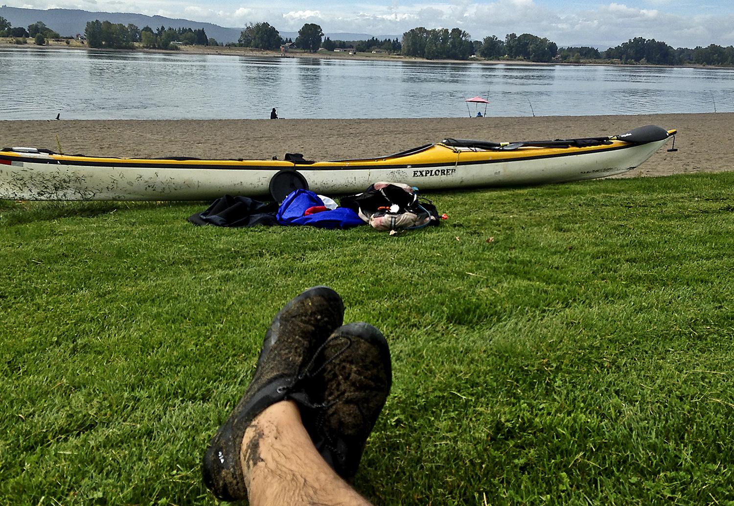
At Frenchman’s Bar, I hear a massive roar of wings—an enormous flock of geese is taking flight all at once, a sure sign of some kind of predator. Eventually I spot the culprit: a northern harrier, also known as a marsh hawk, looking to see if any birds are slow to take off. Then I’m back at the beach. After 43 miles and two days, the long carry up the beach seems even longer than it was the day before. But it’s a trip I’ve always wanted to do, and I’m a good kind of tired.
Why you should go: To explore both quiet channels and the wide-open Columbia around an island that’s a big part of Portland. Camping at a boat-in campground, and lots of wildlife, especially winter and spring.
If you go: Keep an eye on the tides and use the flood currents to head upriver through Multnomah Channel.
Distance: 43 miles around Sauvie Island, but many shorter trips are available, starting at just a couple of miles.
Launch and Land: Many access points: Frenchman’s Bar, Scappoose Bay, Sauvie Island Boat Ramp on Multnomah Channel, Cathedral Park or Kelley Point Park on the Willamette.
Nearby: Plenty of food and lodging options in Scappoose, Vancouver, or North Portland. And if it’s your thing, the clothing-optional beach at Collins Beach on Sauvie Island.